 vesseltracker.com
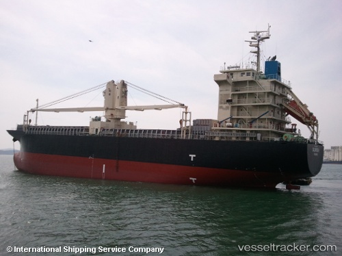
 BERKAY N
Current Status
Where is the vessel?
BERKAY N is currently in Near Sériphos, based on AIS data received less than 1h ago.
Latest AIS update:
Current position: 37.05850° N, 24.53387° E (Near Sériphos)
Average speed (last 7 days): Loading…
Average speed (last 30 days): Loading…
Vessel profile: BERKAY N is a General Cargo Ship with dimensions 105m x 20m.
This page combines live AIS, route history, probable destination signals, nearby traffic, and port activity for practical vessel monitoring.
The current position of vessel BERKAY N is 37.05850 lat / 24.53387 lng. Updated: 2026-05-15 07:53:32 UTCNearest reference points:
- Near Kéa (Tzia)
- 17 nm W of Milos (Adamas)
- Near PISO LIVADI
Currently sailing under the flag of Barbados ![]()
BERKAY N built in 2008 year
Deadweight:
12046 tDetails:
Live Vessel BERKAY N Analytics (details, animations, etc.)
Recent AIS points (UTC):
2026-05-15 04:17:33 UTC · 37.38050, 25.01683 · SOG 8.5 kn · COG 233°2026-05-15 05:38:13 UTC · 37.26459, 24.82934 · SOG 8.6 kn · COG 230°
2026-05-15 07:29:13 UTC · 37.09052, 24.59044 · SOG 8.3 kn · COG 236°
2026-05-15 07:53:32 UTC · 37.05850, 24.53387 · SOG 8.1 kn · COG 235°