 vesseltracker.com
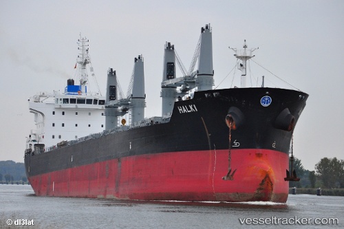
Halki
Current StatusWhere is the vessel?
Halki is currently in 21 nm E of Paranagua, based on AIS data received less than 1h ago.
Latest AIS update:
Current position: 25.58938° S, 48.14394° W (21 nm E of Paranagua)
Average speed (last 7 days): Loading…
Average speed (last 30 days): Loading…
Vessel profile: Halki is a Bulk Carrier with dimensions 28m x 186m.
This page combines live AIS, route history, probable destination signals, nearby traffic, and port activity for practical vessel monitoring.
The current position of vessel Halki is -25.58938 lat / -48.14394 lng. Updated: 2026-05-13 19:56:23 UTCNearest reference points:
- 24 nm E of Caioba
- 32 nm E of Caioba
- 10 nm NE of CAMBORIU
Details:
Live Vessel Halki Analytics (details, animations, etc.)
Recent AIS points (UTC):
2026-05-13 16:39:23 UTC · -25.42051, -47.64103 · SOG 10.6 kn · COG 251°2026-05-13 18:20:15 UTC · -25.53262, -47.94441 · SOG 10.6 kn · COG 252°
2026-05-13 19:11:43 UTC · -25.58035, -48.10086 · SOG 8.6 kn · COG 265°
2026-05-13 19:56:23 UTC · -25.58938, -48.14394 · SOG 0.4 kn · COG 311°