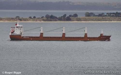
Molengracht
Current StatusWhere is the vessel?
Molengracht is currently in Near Port Huron, based on AIS data received about 14h ago.
Latest AIS update:
Current position: 42.93352° N, 82.45199° W (Near Port Huron)
Average speed (last 7 days): Loading…
Average speed (last 30 days): Loading…
Vessel profile: Molengracht is a General Cargo Ship with dimensions 19m x 143m.
This page combines live AIS, route history, probable destination signals, nearby traffic, and port activity for practical vessel monitoring.
The current position of vessel Molengracht is 42.93352 lat / -82.45199 lng. Updated: 2026-05-19 06:22:15 UTCNearest reference points:
- Near Fort Gratiot
- Near Saint Clair Shores
- Near Walkerville
Details:
Live Vessel Molengracht Analytics (details, animations, etc.)
Recent AIS points (UTC):
2026-05-19 02:18:34 UTC · 42.37599, -82.88380 · SOG 10.6 kn · COG 48°2026-05-19 04:23:16 UTC · 42.61920, -82.51610 · SOG 9.6 kn · COG 12°
2026-05-19 04:39:35 UTC · 42.66292, -82.51027 · SOG 9.5 kn · COG 11°
2026-05-19 06:22:15 UTC · 42.93352, -82.45199 · SOG 8.1 kn · COG 30°