 vesseltracker.com
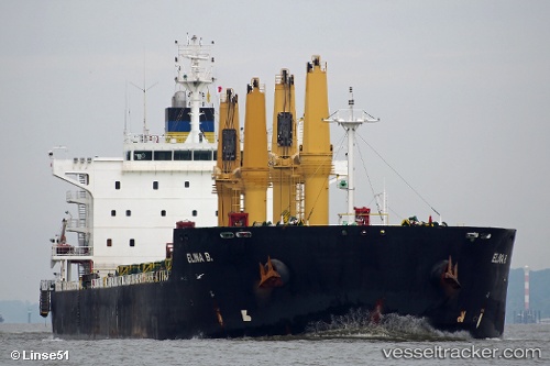
Elina B
Current StatusWhere is the vessel?
Elina B is currently in 28 nm E of Tinaquillo, based on AIS data received about 16h ago.
Latest AIS update:
Current position: 9.96772° N, 68.77390° E (28 nm E of Tinaquillo)
Average speed (last 7 days): Loading…
Average speed (last 30 days): Loading…
Vessel profile: Elina B is a Bulk Carrier with dimensions 32m x 196m.
This page combines live AIS, route history, probable destination signals, nearby traffic, and port activity for practical vessel monitoring.
The current position of vessel Elina B is 9.96772 lat / 68.77390 lng. Updated: 2026-05-17 20:00:15 UTCNearest reference points:
- 119 nm SE of Tinaquillo
- 98 nm S of Tinaquillo
- 130 nm W of Lakshadweep
Details:
Live Vessel Elina B Analytics (details, animations, etc.)
Recent AIS points (UTC):
2026-05-17 17:59:19 UTC · 10.03590, 68.39929 · SOG 11.3 kn · COG 104°2026-05-17 17:59:19 UTC · 10.03590, 68.39929 · SOG 11.3 kn · COG 104°
2026-05-17 20:00:15 UTC · 9.96772, 68.77390 · SOG 11.1 kn · COG 99°
2026-05-17 20:00:15 UTC · 9.96772, 68.77390 · SOG 11.1 kn · COG 99°