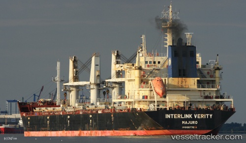
 Interlink Verity
Current Status
Where is the vessel?
Interlink Verity is currently in 97 nm SE of Santa Cruz, based on AIS data received about 20h ago.
Latest AIS update:
Current position: 50.67500° S, 66.11333° W (97 nm SE of Santa Cruz)
Average speed (last 7 days): Loading…
Average speed (last 30 days): Loading…
Vessel profile: Interlink Verity is a Bulk Carrier with dimensions 190m x 190m.
This page combines live AIS, route history, probable destination signals, nearby traffic, and port activity for practical vessel monitoring.
The current position of vessel Interlink Verity is -50.67500 lat / -66.11333 lng. Updated: 2026-05-20 21:38:47 UTCNearest reference points:
- 13 nm NW of Rio Cullen
Currently sailing under the flag of Marshall Is ![]()
Interlink Verity built in 2012 year
Deadweight:
37163 tDetails:
Live Vessel Interlink Verity Analytics (details, animations, etc.)
Recent AIS points (UTC):
2026-05-20 21:38:47 UTC · -50.67500, -66.11333 · SOG 10 kn · COG -1°2026-05-20 21:38:47 UTC · -50.67500, -66.11333 · SOG 10 kn · COG -1°
2026-05-20 21:38:47 UTC · -50.67500, -66.11333 · SOG 10 kn · COG -1°
2026-05-20 21:38:47 UTC · -50.67500, -66.11333 · SOG 10 kn · COG -1°