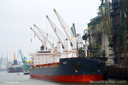
Golf
Current StatusWhere is the vessel?
Golf is currently in 18 nm SW of Pulau Jarak, based on AIS data received about 15h ago.
Latest AIS update:
Current position: 3.79833° N, 99.84333° E (18 nm SW of Pulau Jarak)
Average speed (last 7 days): Loading…
Average speed (last 30 days): Loading…
Vessel profile: Golf is a Bulk Carrier with dimensions 30m x 180m.
This page combines live AIS, route history, probable destination signals, nearby traffic, and port activity for practical vessel monitoring.
The current position of vessel Golf is 3.79833 lat / 99.84333 lng. Updated: 2026-06-22 21:36:03 UTCNearest reference points:
- 43 nm NE of Perbaungan
- 11 nm W of Pangkur
- Near PANGKOR
Details:
Live Vessel Golf Analytics (details, animations, etc.)
Recent AIS points (UTC):
2026-06-22 18:18:00 UTC · 4.18833, 99.30500 · SOG 11 kn · COG -1°2026-06-22 19:30:52 UTC · 4.05473, 99.50478 · SOG 11.9 kn · COG 123°
2026-06-22 19:45:04 UTC · 4.02667, 99.54333 · SOG 11 kn · COG -1°
2026-06-22 21:36:03 UTC · 3.79833, 99.84333 · SOG 12 kn · COG -1°