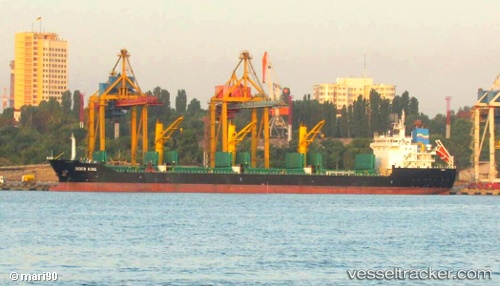
 SIDER KING
Current Status
Where is the vessel?
SIDER KING is currently in 20 nm N of Ain Taya, based on AIS data received about 14h ago.
Latest AIS update:
Current position: 37.10333° N, 3.17167° E (20 nm N of Ain Taya)
Average speed (last 7 days): Loading…
Average speed (last 30 days): Loading…
Vessel profile: SIDER KING is a General Cargo Ship with dimensions 157m x 25m.
This page combines live AIS, route history, probable destination signals, nearby traffic, and port activity for practical vessel monitoring.
The current position of vessel SIDER KING is 37.10333 lat / 3.17167 lng. Updated: 2026-05-19 13:28:13 UTCNearest reference points:
- 16 nm NE of Berja
- Near Algiers
- Near Zamoranos
Currently sailing under the flag of Portugal (MAR) ![]()
SIDER KING built in 2011 year
Deadweight:
25467 tDetails:
Live Vessel SIDER KING Analytics (details, animations, etc.)
Recent AIS points (UTC):
2026-05-19 09:58:12 UTC · 37.18333, 3.83667 · SOG 9 kn · COG -1°2026-05-19 12:02:37 UTC · 37.13946, 3.44419 · SOG 9 kn · COG 260°
2026-05-19 12:52:11 UTC · 37.11667, 3.28833 · SOG 9 kn · COG -1°
2026-05-19 13:28:13 UTC · 37.10333, 3.17167 · SOG 9 kn · COG -1°