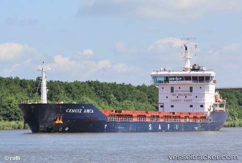
 Cengiz Amca
Current Status
Where is the vessel?
Cengiz Amca is currently in 14 nm W of Carmona, based on AIS data received about 14h ago.
Latest AIS update:
Current position: 37.45905° N, 5.33083° E (14 nm W of Carmona)
Average speed (last 7 days): Loading…
Average speed (last 30 days): Loading…
Vessel profile: Cengiz Amca is a General Cargo Ship with dimensions 132m x 18m.
This page combines live AIS, route history, probable destination signals, nearby traffic, and port activity for practical vessel monitoring.
The current position of vessel Cengiz Amca is 37.45905 lat / 5.33083 lng. Updated: 2026-05-20 19:01:45 UTCNearest reference points:
- Near Carmona
- Near Bejaia
- Near Zamoranos
Currently sailing under the flag of Liberia ![]()
Details:
Live Vessel Cengiz Amca Analytics (details, animations, etc.)
Recent AIS points (UTC):
2026-05-20 16:22:14 UTC · 37.42654, 4.81552 · SOG 9.4 kn · COG 86°2026-05-20 16:27:14 UTC · 37.42762, 4.83185 · SOG 9.4 kn · COG 86°
2026-05-20 17:36:23 UTC · 37.44293, 5.05410 · SOG 9.3 kn · COG 87°
2026-05-20 19:01:45 UTC · 37.45905, 5.33083 · SOG 9.4 kn · COG 89°