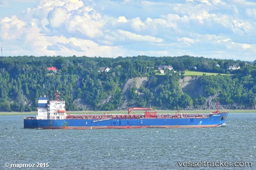
Seasalvia
Current StatusWhere is the vessel?
Seasalvia is currently in 12 nm SW of Dale Roads, based on AIS data received about 14h ago.
Latest AIS update:
Current position: 51.52981° N, 5.31259° W (12 nm SW of Dale Roads)
Average speed (last 7 days): Loading…
Average speed (last 30 days): Loading…
Vessel profile: Seasalvia is a Chemical Oil Products Tanker with dimensions 32m x 183m.
This page combines live AIS, route history, probable destination signals, nearby traffic, and port activity for practical vessel monitoring.
The current position of vessel Seasalvia is 51.52981 lat / -5.31259 lng. Updated: 2026-05-19 03:46:46 UTCNearest reference points:
- 10 nm NW of Grampound
- Near Black Pill
- Near Falmouth
Details:
Live Vessel Seasalvia Analytics (details, animations, etc.)
Recent AIS points (UTC):
2026-05-18 23:59:25 UTC · 51.50041, -5.42378 · SOG 1.7 kn · COG 283°2026-05-19 01:29:55 UTC · 51.52688, -5.41244 · SOG 1.1 kn · COG 291°
2026-05-19 01:32:36 UTC · 51.52726, -5.41144 · SOG 1 kn · COG 294°
2026-05-19 03:46:46 UTC · 51.52981, -5.31259 · SOG 2 kn · COG 296°