 vesseltracker.com
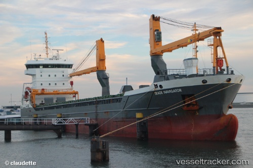
 Trade Navigator
Current Status
Where is the vessel?
Trade Navigator is currently in Near La Pallice, based on AIS data received about 14h ago.
Latest AIS update:
Current position: 46.15740° N, 1.21482° W (Near La Pallice)
Average speed (last 7 days): Loading…
Average speed (last 30 days): Loading…
Vessel profile: Trade Navigator is a General Cargo Ship with dimensions 118m x 16m.
This page combines live AIS, route history, probable destination signals, nearby traffic, and port activity for practical vessel monitoring.
The current position of vessel Trade Navigator is 46.15740 lat / -1.21482 lng. Updated: 2026-05-18 05:48:02 UTCNearest reference points:
- Near La Pallice
- Near La Rochelle
- Near Saint-Pierre-d'Oléron
Currently sailing under the flag of Netherlands ![]()
Details:
Live Vessel Trade Navigator Analytics (details, animations, etc.)
Recent AIS points (UTC):
2026-05-18 01:34:14 UTC · 46.15740, -1.21482 · SOG 0 kn · COG 85°2026-05-18 04:10:23 UTC · 46.15740, -1.21482 · SOG 0 kn · COG 85°
2026-05-18 04:56:23 UTC · 46.15740, -1.21482 · SOG 0 kn · COG 85°
2026-05-18 05:48:02 UTC · 46.15740, -1.21482 · SOG 0 kn · COG 86°