 vesseltracker.com
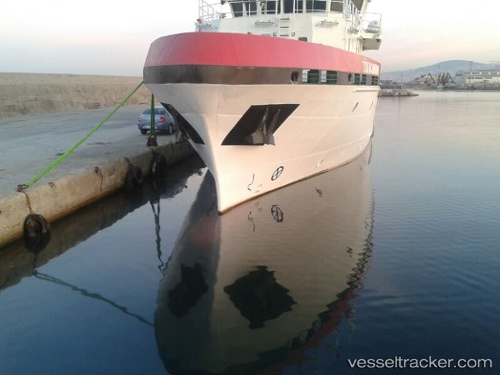
 Tubitak Marmara
Current Status
Where is the vessel?
Tubitak Marmara is currently in Near Trabzon, based on AIS data received less than 1h ago.
Latest AIS update:
Current position: 41.00467° N, 39.73617° E (Near Trabzon)
Average speed (last 7 days): Loading…
Average speed (last 30 days): Loading…
Vessel profile: Tubitak Marmara is a Research Vessel with dimensions 40m x 10m.
This page combines live AIS, route history, probable destination signals, nearby traffic, and port activity for practical vessel monitoring.
The current position of vessel Tubitak Marmara is 41.00467 lat / 39.73617 lng. Updated: 2026-05-01 22:19:57 UTCNearest reference points:
- Near Rize
- 31 nm N of Pazar
- Near Hopa
Currently sailing under the flag of Turkey ![]()
Details:
Live Vessel Tubitak Marmara Analytics (details, animations, etc.)
Recent AIS points (UTC):
2026-05-01 19:10:18 UTC · 41.00467, 39.73616 · SOG 0 kn · COG 199°2026-05-01 20:01:28 UTC · 41.00466, 39.73616 · SOG 0 kn · COG 199°
2026-05-01 22:01:57 UTC · 41.00467, 39.73617 · SOG 0 kn · COG 199°
2026-05-01 22:19:57 UTC · 41.00467, 39.73617 · SOG 0 kn · COG 199°