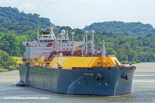
 Kita Lng
Current Status
Where is the vessel?
Kita Lng is currently in 105 nm SW of Wusong Pt, based on AIS data received about 15h ago.
Latest AIS update:
Current position: 1.82333° N, 120.40833° E (105 nm SW of Wusong Pt)
Average speed (last 7 days): Loading…
Average speed (last 30 days): Loading…
Vessel profile: Kita Lng is a Lng Tanker with dimensions 294m x 294m.
This page combines live AIS, route history, probable destination signals, nearby traffic, and port activity for practical vessel monitoring.
The current position of vessel Kita Lng is 1.82333 lat / 120.40833 lng. Updated: 2026-07-08 19:00:23 UTCNearest reference points:
- 81 nm E of Muara Pantai
- 69 nm E of Kaliorang
- 29 nm W of Labuanbajo
Currently sailing under the flag of Malta ![]()
Details:
Live Vessel Kita Lng Analytics (details, animations, etc.)
Recent AIS points (UTC):
2026-07-08 14:42:23 UTC · 1.07667, 119.57333 · SOG 16 kn · COG -1°2026-07-08 17:03:25 UTC · 1.53167, 119.97167 · SOG 16 kn · COG -1°
2026-07-08 18:03:25 UTC · 1.67333, 120.20500 · SOG 16 kn · COG -1°
2026-07-08 19:00:23 UTC · 1.82333, 120.40833 · SOG 15 kn · COG -1°