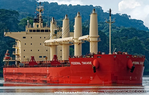
 Federal Takase
Current Status
Where is the vessel?
Federal Takase is currently in Near Shidao Pt, based on AIS data received about 14h ago.
Latest AIS update:
Current position: 36.83437° N, 122.27338° E (Near Shidao Pt)
Average speed (last 7 days): Loading…
Average speed (last 30 days): Loading…
Vessel profile: Federal Takase is a Bulk Carrier with dimensions 190m x 32m.
This page combines live AIS, route history, probable destination signals, nearby traffic, and port activity for practical vessel monitoring.
The current position of vessel Federal Takase is 36.83437 lat / 122.27338 lng. Updated: 2026-05-20 01:47:08 UTCNearest reference points:
- 12 nm W of Shidao Pt
- Near Shidao Pt
- Near SHIDAO
Currently sailing under the flag of Marshall Is ![]()
Details:
Live Vessel Federal Takase Analytics (details, animations, etc.)
Recent AIS points (UTC):
2026-05-19 22:21:44 UTC · 36.83438, 122.27340 · SOG 0.1 kn · COG 180°2026-05-20 00:23:08 UTC · 36.83440, 122.27341 · SOG 0.1 kn · COG 180°
2026-05-20 01:20:08 UTC · 36.83434, 122.27338 · SOG 0.1 kn · COG 180°
2026-05-20 01:47:08 UTC · 36.83437, 122.27338 · SOG 0.1 kn · COG 180°