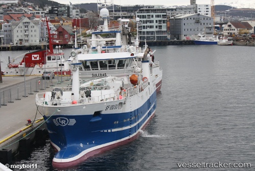
 Sulebas
Current Status
Where is the vessel?
Sulebas is currently in 12 nm NW of Vevang, based on AIS data received about 14h ago.
Latest AIS update:
Current position: 63.15161° N, 7.01054° E (12 nm NW of Vevang)
Average speed (last 7 days): Loading…
Average speed (last 30 days): Loading…
Vessel profile: Sulebas is a Fishing Vessel with dimensions 38m x 10m.
This page combines live AIS, route history, probable destination signals, nearby traffic, and port activity for practical vessel monitoring.
The current position of vessel Sulebas is 63.15161 lat / 7.01054 lng. Updated: 2026-05-22 13:09:16 UTCNearest reference points:
- Near ELNESVAGEN
- Near Aukra
- Near Brattvåg
Currently sailing under the flag of Norway ![]()
Details:
Live Vessel Sulebas Analytics (details, animations, etc.)
Recent AIS points (UTC):
2026-05-22 09:27:23 UTC · 63.28195, 7.13026 · SOG 6.4 kn · COG 17°2026-05-22 10:02:06 UTC · 63.28037, 7.13690 · SOG 0.5 kn · COG 331°
2026-05-22 11:37:28 UTC · 63.26388, 7.12488 · SOG 3.6 kn · COG 212°
2026-05-22 13:09:16 UTC · 63.15161, 7.01054 · SOG 4.3 kn · COG 210°