 vesseltracker.com
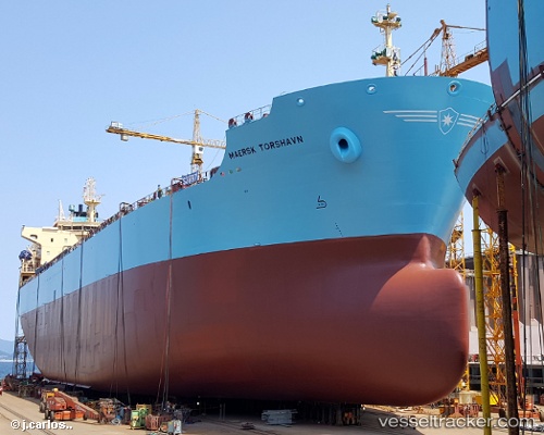
 MAERSK TORSHAVN
Current Status
Where is the vessel?
MAERSK TORSHAVN is currently in Near Napa Napa, based on AIS data received about 1h ago.
Latest AIS update:
Current position: 9.45470° S, 147.13757° E (Near Napa Napa)
Average speed (last 7 days): Loading…
Average speed (last 30 days): Loading…
Vessel profile: MAERSK TORSHAVN is a Oil/Chemical Tanker with dimensions 183m x 32m.
This page combines live AIS, route history, probable destination signals, nearby traffic, and port activity for practical vessel monitoring.
The current position of vessel MAERSK TORSHAVN is -9.45470 lat / 147.13757 lng. Updated: 2026-04-23 04:47:01 UTCCurrently sailing under the flag of Marshall Islands ![]()
MAERSK TORSHAVN built in 2016 year
Deadweight:
50000 tDetails:
Live Vessel MAERSK TORSHAVN Analytics (details, animations, etc.)
Recent AIS points (UTC):
2026-04-23 00:16:59 UTC · -9.45469, 147.13756 · SOG 0 kn · COG 133°2026-04-23 01:04:54 UTC · -9.45471, 147.13754 · SOG 0 kn · COG 133°
2026-04-23 04:07:58 UTC · -9.45472, 147.13759 · SOG 0 kn · COG 133°
2026-04-23 04:47:01 UTC · -9.45470, 147.13757 · SOG 0 kn · COG 133°