 Interlink Celerity
Current Status
Where is the vessel?
Interlink Celerity is currently in Near KARMOY, based on AIS data received about 15h ago.
Latest AIS update:
Current position: 59.31161° N, 5.32558° E (Near KARMOY)
Average speed (last 7 days): Loading…
Average speed (last 30 days): Loading…
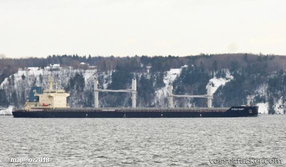
Vessel profile: Interlink Celerity is a Bulk Carrier with dimensions 179m x 32m.
This page combines live AIS, route history, probable destination signals, nearby traffic, and port activity for practical vessel monitoring.
The current position of vessel Interlink Celerity is 59.31161 lat / 5.32558 lng. Updated: 2026-05-20 08:04:27 UTCNearest reference points:
- Near HUSOYA
- Near Storøya
- Near Valevåg
Currently sailing under the flag of Marshall Is ![]()
Details:
Live Vessel Interlink Celerity Analytics (details, animations, etc.)
Recent AIS points (UTC):
2026-05-20 04:43:24 UTC · 59.31164, 5.32559 · SOG 0 kn · COG 338°2026-05-20 06:04:27 UTC · 59.31160, 5.32560 · SOG 0 kn · COG 338°
2026-05-20 07:43:26 UTC · 59.31160, 5.32560 · SOG 0 kn · COG 338°
2026-05-20 08:04:27 UTC · 59.31161, 5.32558 · SOG 0 kn · COG 338°