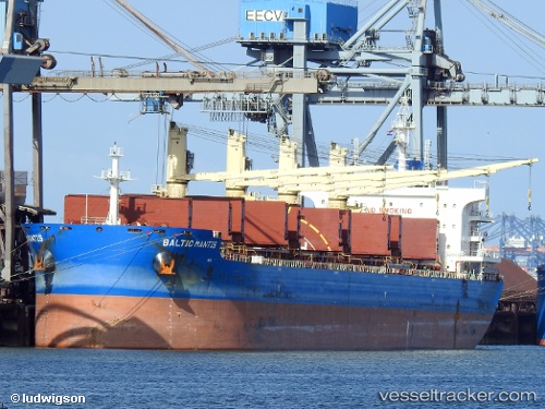
Balticmantis
Current StatusWhere is the vessel?
Balticmantis is currently in 123 nm E of Girard, based on AIS data received about 14h ago.
Latest AIS update:
Current position: 32.90061° N, 40.22113° W (123 nm E of Girard)
Average speed (last 7 days): Loading…
Average speed (last 30 days): Loading…
Vessel profile: Balticmantis is a Bulk Carrier with dimensions 32m x 200m.
This page combines live AIS, route history, probable destination signals, nearby traffic, and port activity for practical vessel monitoring.
The current position of vessel Balticmantis is 32.90061 lat / -40.22113 lng. Updated: 2026-06-14 19:55:38 UTCNearest reference points:
- 197 nm W of Kafr Kanna
Details:
Live Vessel Balticmantis Analytics (details, animations, etc.)
Recent AIS points (UTC):
2026-06-14 17:19:27 UTC · 33.05833, -39.63833 · SOG 11 kn · COG -1°2026-06-14 18:03:41 UTC · 33.01448, -39.80190 · SOG 11.8 kn · COG 254°
2026-06-14 19:26:31 UTC · 32.92866, -40.11248 · SOG 11.7 kn · COG 254°
2026-06-14 19:55:38 UTC · 32.90061, -40.22113 · SOG 11.8 kn · COG 257°