 Kasteelborg
Current Status
Where is the vessel?
Kasteelborg is currently in 16 nm SW of Neeltje Jans, based on AIS data received about 14h ago.
Latest AIS update:
Current position: 53.40702° N, 3.44206° E (16 nm SW of Neeltje Jans)
Average speed (last 7 days): Loading…
Average speed (last 30 days): Loading…
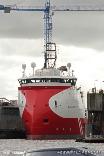
Vessel profile: Kasteelborg is a Offshore Tug Supply Ship with dimensions 84m x 18m.
This page combines live AIS, route history, probable destination signals, nearby traffic, and port activity for practical vessel monitoring.
The current position of vessel Kasteelborg is 53.40702 lat / 3.44206 lng. Updated: 2026-05-19 21:39:54 UTCNearest reference points:
- 19 nm NW of Neeltje Jans
- Near Neeltje Jans
- 23 nm N of de Ruyter
Currently sailing under the flag of Netherlands ![]()
Details:
Live Vessel Kasteelborg Analytics (details, animations, etc.)
Recent AIS points (UTC):
2026-05-19 17:22:28 UTC · 53.26336, 3.75434 · SOG 3 kn · COG 225°2026-05-19 19:28:10 UTC · 53.28715, 3.56107 · SOG 3.8 kn · COG 259°
2026-05-19 19:31:57 UTC · 53.28754, 3.55284 · SOG 4.3 kn · COG 259°
2026-05-19 21:39:54 UTC · 53.40702, 3.44206 · SOG 3.1 kn · COG 322°