 AVRA.GR
Current Status
Where is the vessel?
AVRA.GR is currently in Near Kwinana, based on AIS data received about 14h ago.
Latest AIS update:
Current position: 32.24164° S, 115.75496° E (Near Kwinana)
Average speed (last 7 days): Loading…
Average speed (last 30 days): Loading…
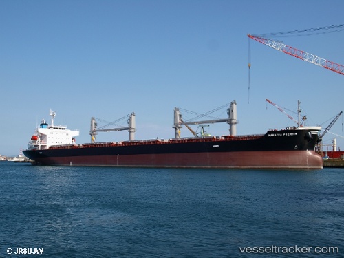
Vessel profile: AVRA.GR is a Bulk Carrier with dimensions 180m x 180m.
This page combines live AIS, route history, probable destination signals, nearby traffic, and port activity for practical vessel monitoring.
The current position of vessel AVRA.GR is -32.24164 lat / 115.75496 lng. Updated: 2026-05-19 23:06:32 UTCNearest reference points:
- Near Kwinana
- Near Fremantle
- Near ROTTNEST ISLAND
Currently sailing under the flag of Marshall Islands ![]()
AVRA.GR built in 2016 year
Deadweight:
34930 tDetails:
Live Vessel AVRA.GR Analytics (details, animations, etc.)
Recent AIS points (UTC):
2026-05-19 19:18:30 UTC · -32.24164, 115.75495 · SOG 0 kn · COG 194°2026-05-19 20:15:30 UTC · -32.24166, 115.75495 · SOG 0 kn · COG 194°
2026-05-19 21:24:29 UTC · -32.24162, 115.75500 · SOG 0 kn · COG 194°
2026-05-19 23:06:32 UTC · -32.24164, 115.75496 · SOG 0 kn · COG 194°