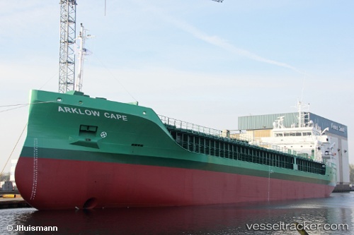
 Arklow Cape
Current Status
Where is the vessel?
Arklow Cape is currently in Near Getxo, based on AIS data received about 15h ago.
Latest AIS update:
Current position: 43.66605° N, 2.99682° W (Near Getxo)
Average speed (last 7 days): Loading…
Average speed (last 30 days): Loading…
Vessel profile: Arklow Cape is a Multi Purpose Carrier with dimensions 87m x 15m.
This page combines live AIS, route history, probable destination signals, nearby traffic, and port activity for practical vessel monitoring.
The current position of vessel Arklow Cape is 43.66605 lat / -2.99682 lng. Updated: 2026-07-04 10:13:42 UTCNearest reference points:
- Near Zierbena
- Near Santurtz
- Near Mundaka
Currently sailing under the flag of Ireland ![]()
Details:
Live Vessel Arklow Cape Analytics (details, animations, etc.)
Recent AIS points (UTC):
2026-07-04 07:30:43 UTC · 43.33733, -3.03268 · SOG 0 kn · COG 280°2026-07-04 07:48:33 UTC · 43.33733, -3.03270 · SOG 0.1 kn · COG 280°
2026-07-04 09:58:52 UTC · 43.62933, -3.01020 · SOG 9.3 kn · COG 18°
2026-07-04 10:13:42 UTC · 43.66605, -2.99682 · SOG 9.2 kn · COG 22°