 vesseltracker.com
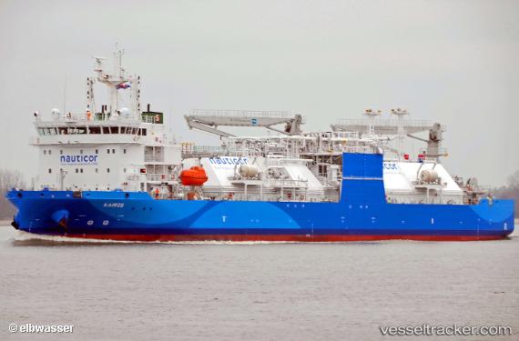
 Kairos
Current Status
Where is the vessel?
Kairos is currently in Near Bünsdorf, based on AIS data received about 15h ago.
Latest AIS update:
Current position: 54.34539° N, 9.75769° E (Near Bünsdorf)
Average speed (last 7 days): Loading…
Average speed (last 30 days): Loading…
Vessel profile: Kairos is a Lng Tanker with dimensions 117m x 20m.
This page combines live AIS, route history, probable destination signals, nearby traffic, and port activity for practical vessel monitoring.
The current position of vessel Kairos is 54.34539 lat / 9.75769 lng. Updated: 2026-05-18 07:51:13 UTCNearest reference points:
- Near BORGSTEDT
- Near Borgwedel
- Near Fahrdorf
Currently sailing under the flag of Cyprus ![]()
Details:
Live Vessel Kairos Analytics (details, animations, etc.)
Recent AIS points (UTC):
2026-05-18 04:49:14 UTC · 54.15185, 9.36936 · SOG 6.8 kn · COG 59°2026-05-18 05:33:35 UTC · 54.18555, 9.50007 · SOG 6.7 kn · COG 66°
2026-05-18 07:38:54 UTC · 54.33006, 9.72707 · SOG 6.9 kn · COG 47°
2026-05-18 07:51:13 UTC · 54.34539, 9.75769 · SOG 6.8 kn · COG 49°