 vesseltracker.com
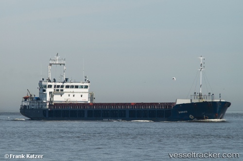
 TAGUS RIVER
Current Status
Where is the vessel?
TAGUS RIVER is currently in Near YARIMCA, based on AIS data received about 14h ago.
Latest AIS update:
Current position: 40.76883° N, 29.72451° E (Near YARIMCA)
Average speed (last 7 days): Loading…
Average speed (last 30 days): Loading…
Vessel profile: TAGUS RIVER is a General Cargo Ship with dimensions m x 121m.
This page combines live AIS, route history, probable destination signals, nearby traffic, and port activity for practical vessel monitoring.
The current position of vessel TAGUS RIVER is 40.76883 lat / 29.72451 lng. Updated: 2026-05-17 23:37:17 UTCNearest reference points:
- Near YARIMCA
- Near KORFEZ
- Near Derince
Currently sailing under the flag of Panama ![]()
TAGUS RIVER built in 2007 year
Deadweight:
6354 tDetails:
Live Vessel TAGUS RIVER Analytics (details, animations, etc.)
Recent AIS points (UTC):
2026-05-17 19:31:17 UTC · 40.76882, 29.72452 · SOG 0 kn · COG 352°2026-05-17 21:55:18 UTC · 40.76881, 29.72455 · SOG 0 kn · COG 352°
2026-05-17 23:07:17 UTC · 40.76883, 29.72452 · SOG 0 kn · COG 351°
2026-05-17 23:37:17 UTC · 40.76883, 29.72451 · SOG 0 kn · COG 350°