 vesseltracker.com
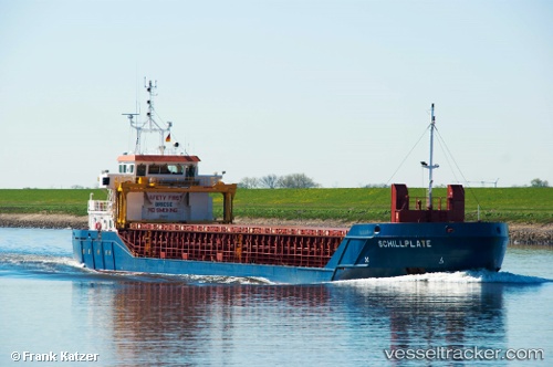
 Schillplate
Current Status
Where is the vessel?
Schillplate is currently in Near Warnemunde, based on AIS data received about 15h ago.
Latest AIS update:
Current position: 54.15873° N, 12.09336° E (Near Warnemunde)
Average speed (last 7 days): Loading…
Average speed (last 30 days): Loading…
Vessel profile: Schillplate is a Multi Purpose Carrier with dimensions 86m x 12m.
This page combines live AIS, route history, probable destination signals, nearby traffic, and port activity for practical vessel monitoring.
The current position of vessel Schillplate is 54.15873 lat / 12.09336 lng. Updated: 2026-05-18 07:50:49 UTCNearest reference points:
- Near Warnemunde
- Near Rostock
- 10 nm NW of Graal-Müritz
Currently sailing under the flag of Gibraltar ![]()
Schillplate built in 2009 year
Deadweight:
3175 tDetails:
Live Vessel Schillplate Analytics (details, animations, etc.)
Recent AIS points (UTC):
2026-05-18 04:47:50 UTC · 54.15858, 12.09334 · SOG 0 kn · COG 7°2026-05-18 05:32:48 UTC · 54.15863, 12.09333 · SOG 0 kn · COG 6°
2026-05-18 07:38:49 UTC · 54.15871, 12.09341 · SOG 0 kn · COG 6°
2026-05-18 07:50:49 UTC · 54.15873, 12.09336 · SOG 0 kn · COG 6°