 vesseltracker.com
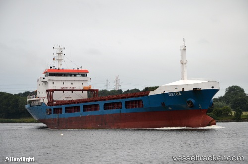
Ostra
Current StatusWhere is the vessel?
Ostra is currently in Near Poti, based on AIS data received about 14h ago.
Latest AIS update:
Current position: 42.16040° N, 41.61190° E (Near Poti)
Average speed (last 7 days): Loading…
Average speed (last 30 days): Loading…
Vessel profile: Ostra is a General Cargo Ship with dimensions 17m x 100m.
This page combines live AIS, route history, probable destination signals, nearby traffic, and port activity for practical vessel monitoring.
The current position of vessel Ostra is 42.1604 lat / 41.6119 lng. Updated: 2026-05-18 01:59:44 UTCNearest reference points:
- Near Poti
- Near KULEVI
- Near Sup'sa
Details:
Live Vessel Ostra Analytics (details, animations, etc.)
Recent AIS points (UTC):
2026-05-17 22:14:44 UTC · 42.15960, 41.61150 · SOG 0 kn · COG 107°2026-05-17 22:23:44 UTC · 42.15960, 41.61150 · SOG 0 kn · COG 108°
2026-05-17 23:50:45 UTC · 42.15980, 41.61160 · SOG 0 kn · COG 114°
2026-05-18 01:59:44 UTC · 42.16040, 41.61190 · SOG 0.1 kn · COG 115°