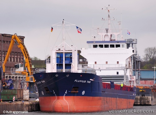
 Fluvius Taw
Current Status
Where is the vessel?
Fluvius Taw is currently in Near Terdonk, based on AIS data received about 15h ago.
Latest AIS update:
Current position: 51.15700° N, 3.78302° E (Near Terdonk)
Average speed (last 7 days): Loading…
Average speed (last 30 days): Loading…
Vessel profile: Fluvius Taw is a Multi Purpose Carrier with dimensions 95m x 14m.
This page combines live AIS, route history, probable destination signals, nearby traffic, and port activity for practical vessel monitoring.
The current position of vessel Fluvius Taw is 51.15700 lat / 3.78302 lng. Updated: 2026-07-10 10:42:51 UTCNearest reference points:
- Near Rieme
- Near Oostakker
- Near SLUISKIL
Currently sailing under the flag of Barbados ![]()
Fluvius Taw built in 2000 year
Deadweight:
5050 tDetails:
Live Vessel Fluvius Taw Analytics (details, animations, etc.)
Recent AIS points (UTC):
2026-07-10 07:51:52 UTC · 51.15699, 3.78306 · SOG 0 kn · COG 23°2026-07-10 08:06:52 UTC · 51.15701, 3.78304 · SOG 0 kn · COG 24°
2026-07-10 09:30:54 UTC · 51.15701, 3.78308 · SOG 0 kn · COG 22°
2026-07-10 10:42:51 UTC · 51.15700, 3.78302 · SOG 0 kn · COG 22°