 vesseltracker.com
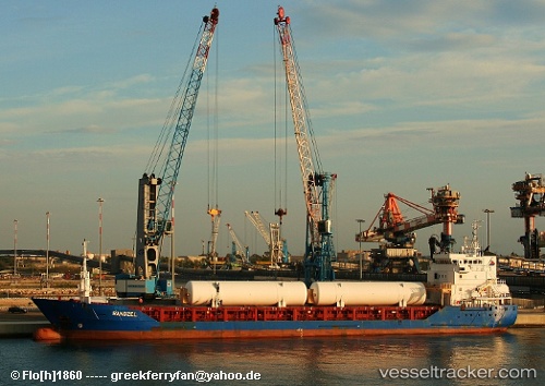
 Randzel
Current Status
Where is the vessel?
Randzel is currently in Near Al Adabiyah, based on AIS data received about 1h ago.
Latest AIS update:
Current position: 29.77167° N, 32.59500° E (Near Al Adabiyah)
Average speed (last 7 days): Loading…
Average speed (last 30 days): Loading…
Vessel profile: Randzel is a Multi Purpose Carrier with dimensions 98m x 13m.
This page combines live AIS, route history, probable destination signals, nearby traffic, and port activity for practical vessel monitoring.
The current position of vessel Randzel is 29.77167 lat / 32.59500 lng. Updated: 2026-05-01 17:14:13 UTCNearest reference points:
- Near Al Adabiyah
- Near Ras Sudr
- Near SUEZ PORT
Currently sailing under the flag of Gibraltar ![]()
Randzel built in 2006 year
Deadweight:
4525 tDetails:
Live Vessel Randzel Analytics (details, animations, etc.)
Recent AIS points (UTC):
2026-05-01 13:43:02 UTC · 29.77103, 32.59620 · SOG 0 kn · COG 340°2026-05-01 16:07:01 UTC · 29.77091, 32.59572 · SOG 0 kn · COG 5°
2026-05-01 16:43:01 UTC · 29.77088, 32.59562 · SOG 0 kn · COG 11°
2026-05-01 17:14:13 UTC · 29.77167, 32.59500 · SOG 0 kn · COG -1°