 VALENTINA
Current Status
Where is the vessel?
VALENTINA is currently in 18 nm SW of Vescovato, based on AIS data received about 14h ago.
Latest AIS update:
Current position: 42.33081° N, 9.77974° W (18 nm SW of Vescovato)
Average speed (last 7 days): Loading…
Average speed (last 30 days): Loading…
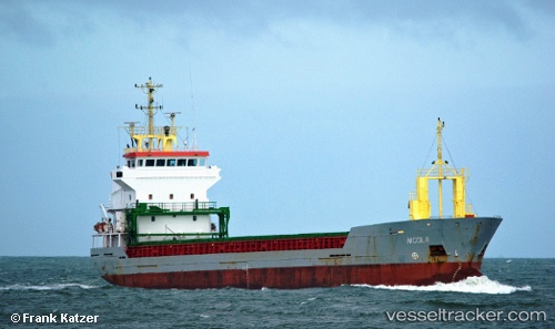
Vessel profile: VALENTINA is a General Cargo Ship with dimensions 95m x 12m.
This page combines live AIS, route history, probable destination signals, nearby traffic, and port activity for practical vessel monitoring.
The current position of vessel VALENTINA is 42.33081 lat / -9.77974 lng. Updated: 2026-07-10 05:16:02 UTCNearest reference points:
- 40 nm NW of Sarinena
- 11 nm S of Sarinena
- Near Corujo
Currently sailing under the flag of Barbados ![]()
VALENTINA built in 2000 year
Deadweight:
5050 tDetails:
Live Vessel VALENTINA Analytics (details, animations, etc.)
Recent AIS points (UTC):
2026-07-10 01:41:32 UTC · 41.76334, -9.79077 · SOG 9.9 kn · COG 3°2026-07-10 01:43:52 UTC · 41.76982, -9.79068 · SOG 10.1 kn · COG 3°
2026-07-10 04:07:02 UTC · 42.14621, -9.78370 · SOG 9.8 kn · COG 0°
2026-07-10 05:16:02 UTC · 42.33081, -9.77974 · SOG 9.6 kn · COG 1°