 Gabriel A
Current Status
Where is the vessel?
Gabriel A is currently in Near ALGER, based on AIS data received about 15h ago.
Latest AIS update:
Current position: 36.76790° N, 3.06213° E (Near ALGER)
Average speed (last 7 days): Loading…
Average speed (last 30 days): Loading…
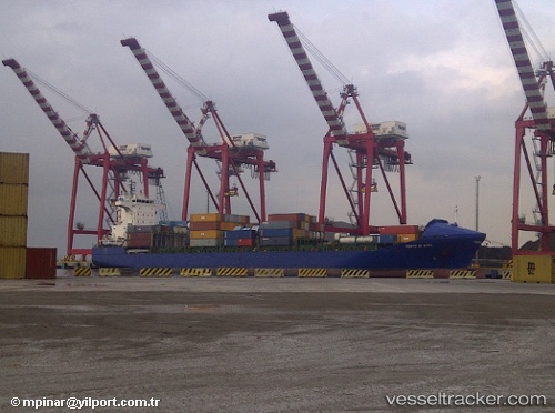
Vessel profile: Gabriel A is a Container Ship with dimensions 155m x 25m.
This page combines live AIS, route history, probable destination signals, nearby traffic, and port activity for practical vessel monitoring.
The current position of vessel Gabriel A is 36.7679 lat / 3.06213 lng. Updated: 2026-05-21 22:10:53 UTCNearest reference points:
- Near Algiers
- 16 nm NE of Berja
- 17 nm S of Albanchez
Currently sailing under the flag of Malta ![]()
Gabriel A built in 2004 year
Deadweight:
17264 tDetails:
Live Vessel Gabriel A Analytics (details, animations, etc.)
Recent AIS points (UTC):
2026-05-21 19:52:53 UTC · 36.76790, 3.06215 · SOG 0 kn · COG 283°2026-05-21 20:10:54 UTC · 36.76790, 3.06215 · SOG 0 kn · COG 284°
2026-05-21 21:52:51 UTC · 36.76790, 3.06215 · SOG 0 kn · COG 284°
2026-05-21 22:10:53 UTC · 36.76790, 3.06213 · SOG 0 kn · COG 284°