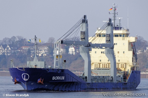
Borkum
Current StatusWhere is the vessel?
Borkum is currently in 11 nm SW of Basrah Oil Terminal, based on AIS data received about 15h ago.
Latest AIS update:
Current position: 29.58991° N, 48.75168° E (11 nm SW of Basrah Oil Terminal)
Average speed (last 7 days): Loading…
Average speed (last 30 days): Loading…
Vessel profile: Borkum is a Multi Purpose Carrier with dimensions 16m x 108m.
This page combines live AIS, route history, probable destination signals, nearby traffic, and port activity for practical vessel monitoring.
The current position of vessel Borkum is 29.58991 lat / 48.75168 lng. Updated: 2026-05-21 04:13:22 UTCNearest reference points:
- 11 nm SW of Basrah Oil Terminal
- 15 nm S of Imam Khomeini Pt/ Mahshahr City
- Near Ra's al Ard
Details:
Live Vessel Borkum Analytics (details, animations, etc.)
Recent AIS points (UTC):
2026-05-20 23:26:51 UTC · 29.20448, 49.10425 · SOG 6.3 kn · COG 301°2026-05-20 23:26:51 UTC · 29.20448, 49.10425 · SOG 6.3 kn · COG 301°
2026-05-21 03:55:12 UTC · 29.56203, 48.76702 · SOG 6.1 kn · COG 322°
2026-05-21 04:13:22 UTC · 29.58991, 48.75168 · SOG 6.1 kn · COG 340°