Tide Navigator
Current StatusWhere is the vessel?
Tide Navigator is currently in Near Nice, based on AIS data received about 14h ago.
Latest AIS update:
Current position: 43.69345° N, 7.28777° E (Near Nice)
Average speed (last 7 days): Loading…
Average speed (last 30 days): Loading…
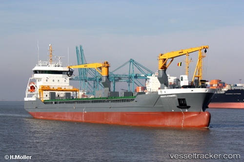
Vessel profile: Tide Navigator is a Multi Purpose Carrier with dimensions 16m x 118m.
This page combines live AIS, route history, probable destination signals, nearby traffic, and port activity for practical vessel monitoring.
The current position of vessel Tide Navigator is 43.69345 lat / 7.28777 lng. Updated: 2026-05-19 01:48:11 UTCNearest reference points:
- Near Nice
- Near Villefranche-sur-Mer
- Near SAINTJEAN CAP FERRAT
Details:
Live Vessel Tide Navigator Analytics (details, animations, etc.)
Recent AIS points (UTC):
2026-05-18 22:56:17 UTC · 43.69344, 7.28776 · SOG 0 kn · COG 285°2026-05-19 00:02:15 UTC · 43.69344, 7.28777 · SOG 0.1 kn · COG 285°
2026-05-19 01:20:16 UTC · 43.69344, 7.28778 · SOG 0 kn · COG 285°
2026-05-19 01:48:11 UTC · 43.69345, 7.28777 · SOG 0 kn · COG 285°