 vesseltracker.com
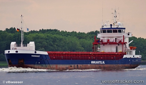
 Haringvliet
Current Status
Where is the vessel?
Haringvliet is currently in Near Portskerra, based on AIS data received less than 1h ago.
Latest AIS update:
Current position: 58.67818° N, 4.04347° W (Near Portskerra)
Average speed (last 7 days): Loading…
Average speed (last 30 days): Loading…
Vessel profile: Haringvliet is a General Cargo Ship with dimensions 89m x 13m.
This page combines live AIS, route history, probable destination signals, nearby traffic, and port activity for practical vessel monitoring.
The current position of vessel Haringvliet is 58.67818 lat / -4.04347 lng. Updated: 2026-05-14 03:22:44 UTCNearest reference points:
- Near STROMNESS
- Near Findhorn
- Near Staxigoe
Currently sailing under the flag of Netherlands ![]()
Haringvliet built in 2012 year
Deadweight:
3850 tDetails:
Live Vessel Haringvliet Analytics (details, animations, etc.)
Recent AIS points (UTC):
2026-05-13 23:31:34 UTC · 58.62756, -5.06610 · SOG 6.3 kn · COG 46°2026-05-14 01:37:24 UTC · 58.66282, -4.55328 · SOG 8.5 kn · COG 87°
2026-05-14 01:49:02 UTC · 58.66395, -4.50146 · SOG 8.8 kn · COG 90°
2026-05-14 03:22:44 UTC · 58.67818, -4.04347 · SOG 9.8 kn · COG 90°